Walking tours · Pottsville
Historic Downtown Pottsville Walking Tour
A self-guided walking tour of historic downtown Pottsville, Pennsylvania — eleven stops in order, from the Civil War memorials of Garfield Square to the cast-iron Henry Clay Monument on the ridge, each linked to its full, sourced history.
Listen to this article · 2 min
0:001:45
Read by a synthetic voice, generated from the text of this article. Hear the whole archive on the Listen page.
The interactive map loads as an enhancement. Every stop is listed below in walking order, each linked to its page.
Pottsville grew up as the seat of Schuylkill County and a commercial center of the southern anthracite coal field, and the wealth of the nineteenth-century coal-and-iron boom is written into its downtown: a dense few blocks of theatres, ironmasters’ mansions, volunteer firehouses, and war memorials, much of it now gathered into the Pottsville Downtown Historic District, listed on the National Register of Historic Places in 1982. This self-guided route reads that landscape in roughly geographic order — eleven stops, all within the downtown core.
It begins in Garfield Square, the city’s civic green, where two war memorials stand a few steps apart; turns north to the North Centre Street theatre block, the volunteer fire companies whose lineages reach back to the 1820s, and the 1865 schoolhouse that now houses the county’s Historical Society; then follows Centre Street south to an ironmaster’s mansion and, finally, climbs the ridge to the Henry Clay Monument, the cast-iron landmark that has overlooked the city since 1855.
The throughline is a downtown that built grandly and then had to choose what to keep. Nowhere is that clearer than on North Centre Street, where the restored Majestic still raises its curtain two doors from the footprint of the Capitol — the larger movie palace the city demolished in 1982, the same year it gained its historic district.
Each stop below links to its full, sourced history on Schuylkill Hub. The map plots the stops and connects them with a dashed line that shows only the suggested order; it is not a walking route, turn-by-turn directions, or a measured path, so check the map and your own footing as you go. The final climb to the Henry Clay Monument is steep and reached by a narrow road.
The route — 11 stops in order
-
Soldiers' & Sailors' Monument (Schuylkill County Civil War Monument) Monuments
The walk begins at the center of Garfield Square, where Schuylkill County's principal Civil War memorial rises about sixty feet — a granite column ringed by four bronze service figures, unveiled in 1891 to honor the roughly 13,000 county men who served the Union.
Read its full history -
Spanish War Veterans Memorial ("The Hiker") Monuments
A few steps east in the same square stands "The Hiker," a 1927 bronze of a Spanish-American War infantryman — one of some fifty Gorham castings of Theo Alice Ruggles Kitson's figure placed across the country, so a single landscaped square narrates two eras of American service.
Read its full history -
Discovery Park Monuments
Continue east on West Market to the northwest corner of Third Street, where Discovery Park — dedicated in 2025 on the lot of the vanished "Market Street House" hotel — turns a long-empty corner into a children's park and a memorial. Megan Price's 2½-story mural reads the city's volunteer-firefighting history from 1829 to 2018, and the park realizes a downtown vision of the late Mayor Terry Reiley.
Read its full history -
The Pottsville Free Public Library Historic buildings
Directly across Third Street from Discovery Park stands the Pottsville Free Public Library — a 1922 red-brick Georgian Revival hall the town likened to Independence Hall, built on the old Rosengarten homestead with a Sheafer family memorial gift and a Carnegie grant the city council had first refused.
Read its full history -
The Lee Building Historic buildings
Toward Centre Street on West Market stands the Lee Building, a brick-and-terra-cotta commercial block of 1909–10 attributed to Frank X. Reilly — a downtown counterpart to the theatres ahead, built for shops and offices, that held the county's trolley company, then the power company, then three generations of the Logothetides family's restaurants.
Read its full history -
Pottsville Fire Company No. 1 (Humane & Phoenix) Historic buildings
Turn north toward Humane Avenue to Pottsville Fire Company No. 1 — by constitution the city's newest volunteer company, by lineage its oldest, tracing through the Humane and Phoenix companies to 1829 and the town's earliest volunteer firefighting.
Read its full history -
The Majestic Theatre Historic buildings
On North Centre Street, the Majestic opened in 1910 as a vaudeville-and-moving-picture house, closed with the coming of the talkies in 1930, spent decades as a farmers' market, and reopened restored in 2006 — the survivor of a block once thick with theatres.
Read its full history -
The Capitol Theatre Historic buildings
Two doors up stood the Capitol, a roughly 2,700-seat movie palace of 1927 that took the city's first talkies. Individually listed on the National Register in 1980, it was demolished for a parking deck in 1982 — the same year the downtown historic district was listed.
Read its full history -
The Centre Street Grammar School Historic buildings
A block farther up Centre Street stands the Centre Street Grammar School — John Fraser's three-story schoolhouse of 1863–65, built as the borough's Female Grammar School on ground that had held a school since 1819. It taught for more than a century, closed in 1982, and since 2002 has been home to the Schuylkill County Historical Society — the county's history museum and research library.
Read its full history -
The Pottsville Moose Home (Charles M. Atkins Mansion) Historic buildings
Follow Centre Street south to the former Atkins Mansion, built around 1865 for ironmaster Charles M. Atkins and home to the Loyal Order of Moose Lodge No. 411 from 1917 to 1994. It still stands — now professional offices — within the downtown historic district.
Read its full history -
Henry Clay Monument Monuments
The route ends with a climb to the ridge above downtown, where a cast-iron statue of Henry Clay has crowned a sixty-seven-foot Doric column since 1855 — recorded as the first monument to Clay in the country, raised by a coal region that prized his pro-industry politics. The steep, narrow approach makes it the hardest stop to reach.
Read its full history
From the archive
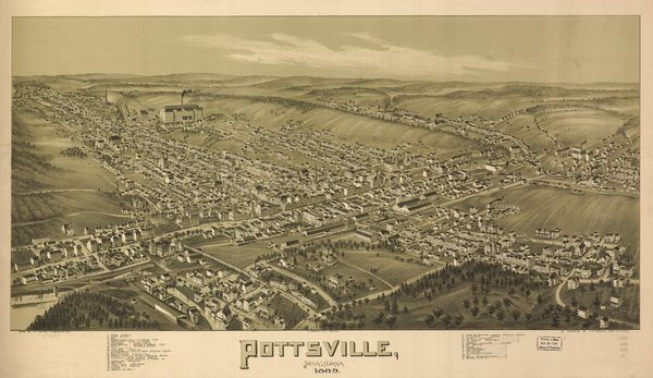
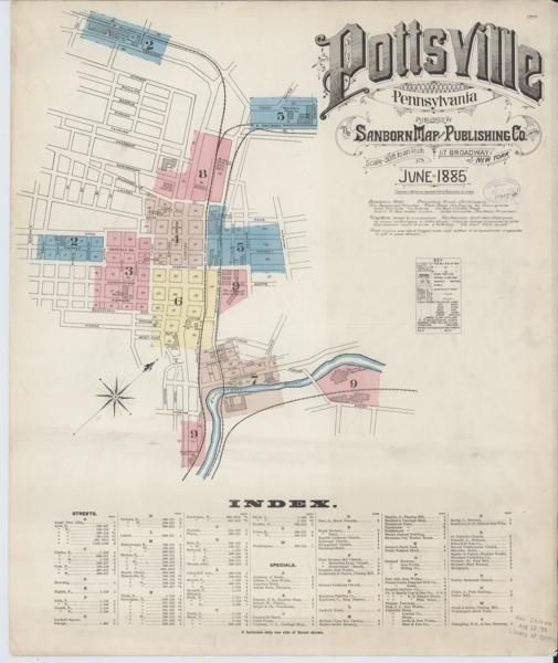
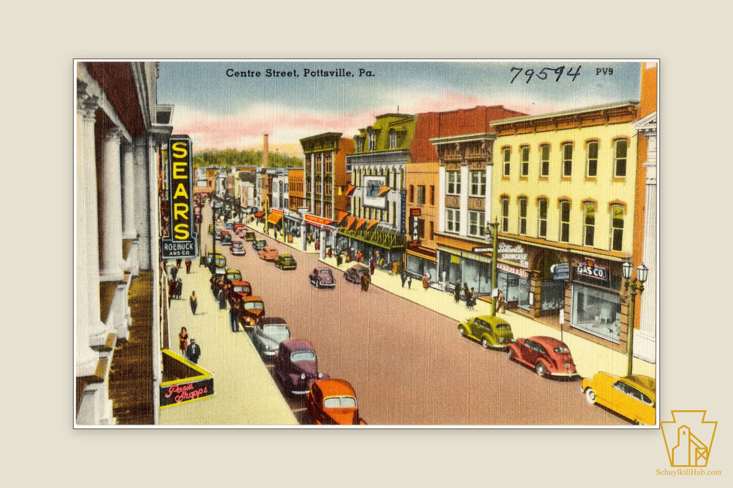
Historic maps and photographs from the Schuylkill Hub archive, each available as an archival print.
Sources
This route is curated from the Schuylkill Hub record; each stop links to its fully-sourced page. The tour's overview draws on:
Frequently asked
- How long is the historic downtown Pottsville walking tour?
- It links eleven stops across the downtown core, from Garfield Square to the Henry Clay Monument. It is a self-guided route rather than a timed or measured walk, so go at your own pace — and note that the final climb to the Henry Clay Monument is steep and reached by a narrow road.
- Is this an official or guided tour?
- No. It is a self-guided route curated by Schuylkill Hub from our published, sourced histories of each site, and every stop links to its full page. The dashed line on the map shows the suggested order of the stops — not a walking route, directions, or a measured path.
- Do I have to follow the stops in order?
- No. The order is a suggestion that keeps the walk roughly geographic, beginning in Garfield Square and ending uphill at the Henry Clay Monument. You can visit the stops in whatever order suits you.