Hidden Creek: A History of the Schuylkill River to 1950
Listen to this article · 26 min
0:0026:29
Read by a synthetic voice, generated from the text of this article. Hear the whole archive on the Listen page.
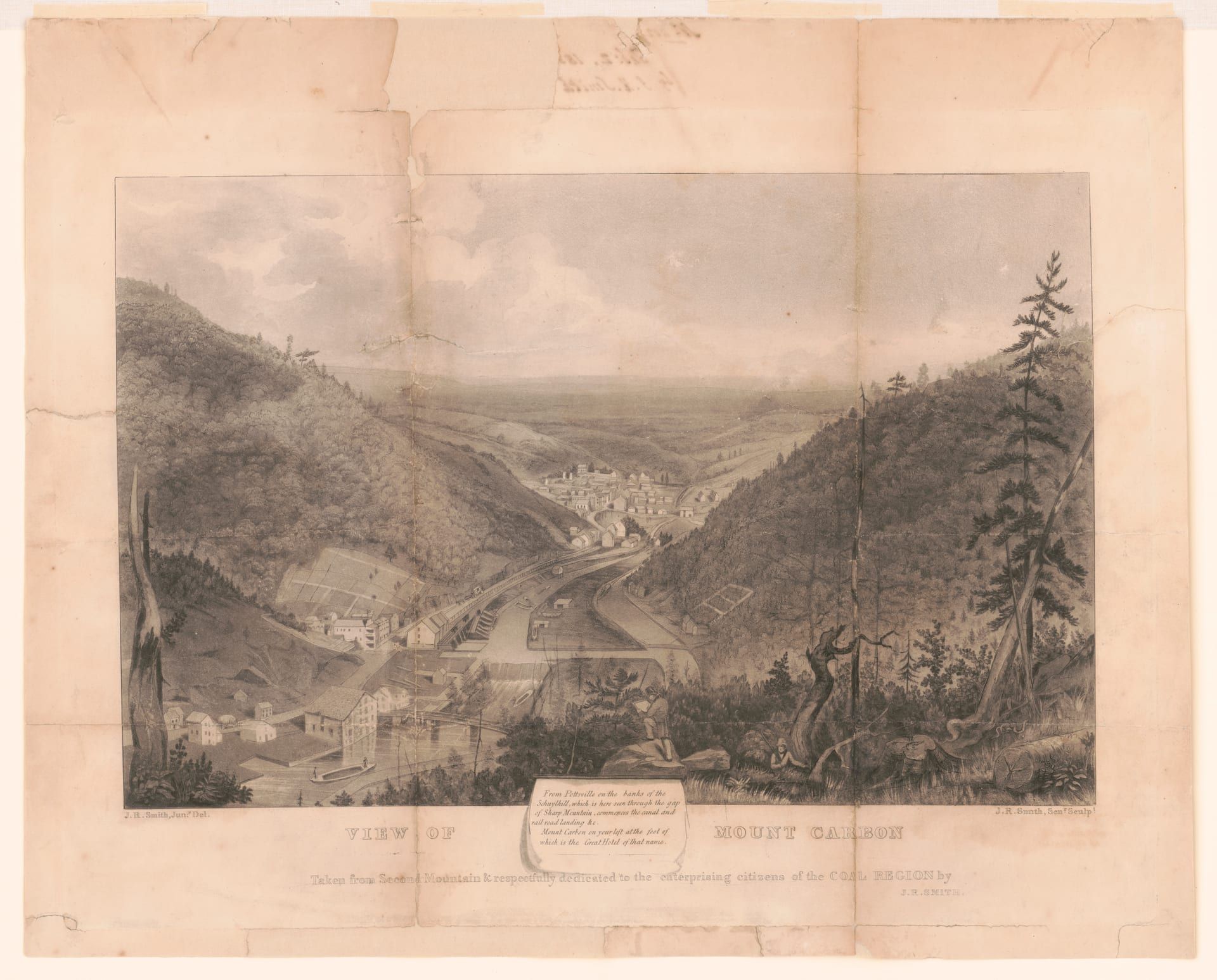
The Schuylkill is the river that made Schuylkill County — and the county, for a century, nearly unmade the river. Its name is Dutch for “hidden creek,” after the marsh-obscured mouth where it meets the Delaware at Philadelphia; its entire headwater system rises in Schuylkill County, on the most intensively mined ground in the anthracite region. Between its charter in 1815 and its dissolution in 1946, the Schuylkill Navigation turned the river into the coal road of the mid-Atlantic, built the county’s canal-port towns, and multiplied the county’s population five times over in thirty years. The same coal paid the river back in silt: by 1927 the river system held an estimated 38 million tons of coal waste, the county’s own canal reaches were the first to choke, and in 1945 Pennsylvania passed a law with the river’s name in its title to dig the whole bargain back out. This is the river’s story to 1950 — told from the county where it begins.
Provenance markers: verified — quoted or checked against a primary page scan, official record, or first-hand data · corroborated — an authoritative secondary source · corrected in research · single-source, tradition, or open. Period quotations were re-verified against the Internet Archive scans of the 1881 county history; bracketed words are editorial normalizations of the scanned text.
At a glance
A quick map of the article; each point is sourced in the section that follows.
- The name: Dutch schuilen + kil — “hidden creek,” for the concealed mouth. The Lenape called the river Ganshowehanne, “the noisy stream.”
- The source: every branch rises in Schuylkill County — East Branch near Tuscarora, West Branch near Minersville, the Little Schuylkill at Port Clinton.
- The canal: chartered March 8, 1815; first dam at Mount Carbon, 1817; upper terminus at Port Carbon, 1828; about 108 miles to Philadelphia.
- The boom: first coal poled down in 1822 (1,480 tons); peak traffic 1,699,101 tons in 1859; county population 11,311 (1820) → 60,713 (1850).
- The reckoning: “for every ton shipped to market, two are wasted” (1881) — the county’s canal reaches silted out and were abandoned by ~1887–1891; the last anthracite cargo on the system moved in 1931.
- The cleanup: Act 441, June 4, 1945; dredging 1947–51 removed at least 16.5 million cubic yards of silt; the desilting works at Tamaqua and Auburn (Landingville) still stand in the county.
The hidden creek and its names
The river’s names carry its earliest history. The Dutch, trading on the Delaware from the 1620s, named the stream whose mouth their sloops kept missing: Schuylkill, from schuilen, “to hide or shelter,” and kil, “channel” or “creek.” Francis Vincent’s 1870 history of Delaware puts it plainly: the river “was so named by the Dutch. In their language it means ‘hidden creek’… from the retired and hidden situation of its mouth.” The linguist Nicoline van der Sijs confirms the same derivation in her study of Dutch in North America. The direct translation is worth insisting on: kil was the colonial Dutch word for a creek or channel, while rivier went to the great streams — the Delaware was the Dutch “South River” — so the “hidden river” of modern usage is a paraphrase; the seventeenth-century name, precisely read, is “hidden creek.” Tradition attributes the naming to Arendt Corssen, the Dutch West India Company agent who acquired ground on the river around 1633 — a fair attribution, but a tradition rather than a documented act.
The people who lived on the river called it something else. The missionary John Heckewelder, the closest thing the Lenape language has to a period lexicographer, recorded the name in his list of Indigenous place-names (communicated 1822): “Schuylkill — Ganshowehanne… der rauschende Strohm [the rushing stream], the noisy stream, occasioned by falls and ripples. It is also called Meneiunk.” The second name — “our place of drinking,” in Heckewelder’s gloss — survives today as Manayunk, the Philadelphia mill neighborhood. The popular rendering of Ganshowehanne as “falling waters” is a later corruption of Heckewelder’s actual entry, which this article does not repeat. Both names were in colonial use side by side: a Swedish map drawn from Peter Lindeström’s 1654–56 surveys records the “Menejackse Kill” with the villages “Passajung and Nittabakonck… situated up at the Menejackse River.” And William Penn’s own 1683 deed speaks of land along the “Manaiunk alias Schulkill.”
The lower river belonged to the Lenape. The ethnohistorian Marshall Becker, whose account of the Lower Merion bands is the most careful available, records that two bands — a North and a South Schuylkill band — held the river; that the band at the mouth, one of the largest, “traditionally summered in the rich swamps at the mouth of the Schuylkill”; and that “until the Swedes arrived in 1638… the Schuylkil River people were the best known of the Lenape bands.” The record even preserves names: when the Dutch raised Fort Beversreede near the mouth in April 1648, the commissary Andries Hudde recorded that two Passyunk chiefs, Mattahorn and Wissemenetto, “themselves took and planted there the Prince’s flag” — and their protest against Swedish settlement survives with them: “The Swede builds and plants, indeed, on our lands, without buying them or asking us.” Penn’s purchases between 1682 and 1701 bought out each band’s holdings, and by about 1740 most Lenape had moved west out of the valley — decades before the county at the river’s head was even settled.
A river born in mined ground
Geography dealt Schuylkill County the whole hand. The river’s East Branch rises on heavily mined ground between the village of Tuscarora and Tamaqua — the spot is identified in modern gazetteers as Tuscarora Springs, a name the county’s own 1881 history does not use — and its West Branch rises near Minersville. The branches join at Schuylkill Haven; the Little Schuylkill, draining Tamaqua’s valley, meets the main stem at Port Clinton, where the river leaves the county through the water gap in Blue Mountain. From there it runs roughly 135 miles in all to the Delaware at Philadelphia, draining a basin of nearly 2,000 square miles across parts of eleven counties. The measured drainage above the federal river gauge at Philadelphia is 1,893 square miles, per the National Weather Service’s gauge record.
The upper basin is the Southern Anthracite Coal Field, the largest of Pennsylvania’s four — the county’s hard-coal story is told in full in the anthracite long read — and the rock formations that hold the coal, the Pottsville and the Llewellyn, are named for county places. The county’s 1881 historians understood exactly what that meant for the water. Their geology chapter observes that “the southern wall of this field in this county is broken by four gaps, through which flow the Little Schuylkill, the main and west branch of the Schuylkill and the Swatara, which receive not only the surface drainage but also that of the [mines].” Broad Mountain, they noted, “is the great water shed of the region for the Susquehanna, the Schuylkill, and the Lehigh rivers.” And already in 1881 — decades before any statewide alarm — the same volume warned that the county’s headwater springs would grow precious “in a district where so much of this essential element is poisoned by impregnations of the mines.”
Settlement came late to this ground: “there is no very authentic evidence that any one had penetrated the wilds as far as the head waters of the Schuylkill, for the purpose of settling there, till after the close of the French and Indian war.” Within two generations of that late start, the wilderness at the river’s source had become the busiest mining district in the eastern United States.
The canal that made the county
The single most consequential thing the river ever did for its county was offer a way out — a water route by which the county’s “black stone” could reach Philadelphia and prove itself as fuel. When promoters first sought a charter in 1812, the county’s own senator killed it, rising in his place to say “there was no coal in Schuylkill county; there was a kind of black stone that was called coal, but it would not burn.” The Schuylkill Navigation Company was chartered anyway, three years later — “incorporated by an act of Assembly approved by Governor Simon Snyder March 8th, 1815,” as the county history records, to carry lumber, produce, “and the coal which some then thought would become an important article of trade.”
Construction began in the county: “Work was commenced and the first dam built on this navigation at Mount Carbon, in the spring of 1817,” and that same summer the works were navigable between Mount Carbon and Schuylkill Haven. A decade later the company pushed two miles further upriver: “In 1827 the work of extending the navigation to the mouth of Mill creek was commenced, and it was completed in 1828” — the mouth of Mill Creek being Port Carbon, the system’s upper terminus. As finished, the navigation ran about 108 miles from Port Carbon to Philadelphia — roughly 62 miles of dug canal and 46 of slackwater pools behind dams — with a total fall its own surveys put at 618.76 feet, stepping down through some 120 lock chambers (consolidated and renumbered 1–72 in the 1846 enlargement). Above Port Clinton the company drove what its neighbors called “the first [tunnel] driven in North America” — begun about 1818, finished in 1821, originally 450 feet long — a fair claim to the first transportation tunnel in the United States, though it was widened repeatedly and finally “made a thorough cut” in 1855–56, which is why the Union Canal’s 1827 tunnel at Lebanon survives as the country’s oldest.
The trade began absurdly small. “The first shipments of coal by canal were made in the year 1822, when 1,480 tons were poled down the line, the tow-path being yet unmade” — this against the managers’ own 1817 prediction that someday “ten thousand tons of coal per annum would be shipped by canal.” The reference works’ figure for the first full season after the works opened, 5,306 tons in 1825, traces only to company reports and has never been corroborated in the period press. The infancy of the whole business survives in one anecdote: “It is a remarkable fact that in 1824 Abraham Pott took a load of coal — 28 tons — to Philadelphia, and on offering to pay the toll at Reading it was found that, although rates were fixed on every other article, even to a bushel of hickory nuts, coal was not named in the list, and he paid no toll bill afterward.” A toll schedule that taxed hickory nuts but had no line for coal is the perfect emblem of an industry no one had yet imagined.
Imagination caught up fast. Coal tonnage passed 200,000 tons by 1832 and “swelled to over 500,000 tons” in the decade that followed ; the system peaked in 1859 at 1,699,101 tons of cargo, 1,379,109 tons of it anthracite. The county grew with the trade — “About the year 1825 the Schuylkill navigation was completed, giving an outlet for the coal that was mined in the county” — and the census tells the rest:
| Year | Schuylkill County population |
|---|---|
| 1820 | 11,311 |
| 1830 | 20,744 |
| 1840 | 29,053 |
| 1850 | 60,713 |
| 1880 | 128,784 |
Figures from the 1881 county history’s decade table (its trade chapter prints 29,072 for 1840; the decade table’s 29,053 matches the 1840 federal census). The 1850 leap — the population more than doubling in ten years, more than five-fold since 1820 — is the canal-and-coal outlet made visible. The 1829 land rush put it at human scale: “Pottsville, the centre of the movement, overflowed with strangers,” and within the boom that culminated in 1828–29 “nearly $5,000,000 had been invested in the coal lands of Schuylkill county.” Pottsville itself had been laid out in 1816 by the ironmaster John Pott, at the head of the navigation-to-be.
Ports of coal, and the mills the canal displaced
The river’s most legible mark on the county map is a string of towns that exist because of it. Mount Carbon held the first dam and the first head of navigation. Port Carbon, the 1828 terminus, became more than a transshipment point: by 1865 it had a rolling mill and furnace, and its Franklin Iron Works built machinery “shipped to all parts of the United States, and to Australia, New Zealand, South America and Europe.” Schuylkill Haven, at the junction of the branches, is the clearest case of a town made wholly by the river’s traffic: laid out around 1811 on the Dreibelbis family’s mill ground, it was still so thin in 1830 that a Miners’ Journal correspondent quipped “a view of the plot is scarcely interrupted by a house” — yet its “subsequent growth and prosperity have resulted wholly from its situation at the point of shipment for the coal,” and its population kept “even pace with the development of the coal trade,” 988 in 1840 to 3,167 in 1880. Port Clinton guarded the tunnel and the gap where the navigation left the county.
What the county’s river towns did not become is factory seats. Before the canal, the branches turned the ordinary machinery of a frontier county — “fifty years since more than 100 saw-mills were known to be running in the county,” rafting their lumber downriver until “the completion of the Schuylkill navigation put an end to rafting” — but the 1881 history is candid that “saw-mills and grist-mills, and here and there a powder-mill, and a small manufactory of woolen goods, are the only industries utilizing the vast bodies of water” of the county. The canal even displaced the county’s first river mills: the early Dreibelbis saw- and oil-mills at Schuylkill Haven “were taken down by the Schuylkill Navigation Company between 1825 and 1830.” In the county, the river’s gift was transport, not horsepower.
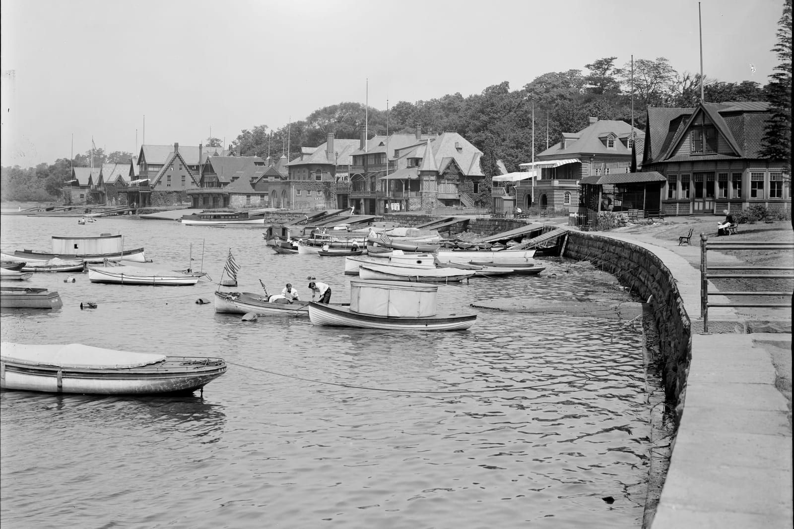
Horsepower was the lower river’s story. At Manayunk, below the Flat Rock Dam, the navigation sold its surplus water to mill owners literally by the square inch — leases “usually taken in blocks of 50 or 100 inches,” at rents that rose from $3 per inch per year to $6 by 1832 — and a village of a few dozen souls held ten mills employing over six hundred workers by 1828, the year a visitor coined its lasting epithet: “the Manchester of America.” The county mined the fuel; the fall line milled the cloth.
The thirsty city downstream
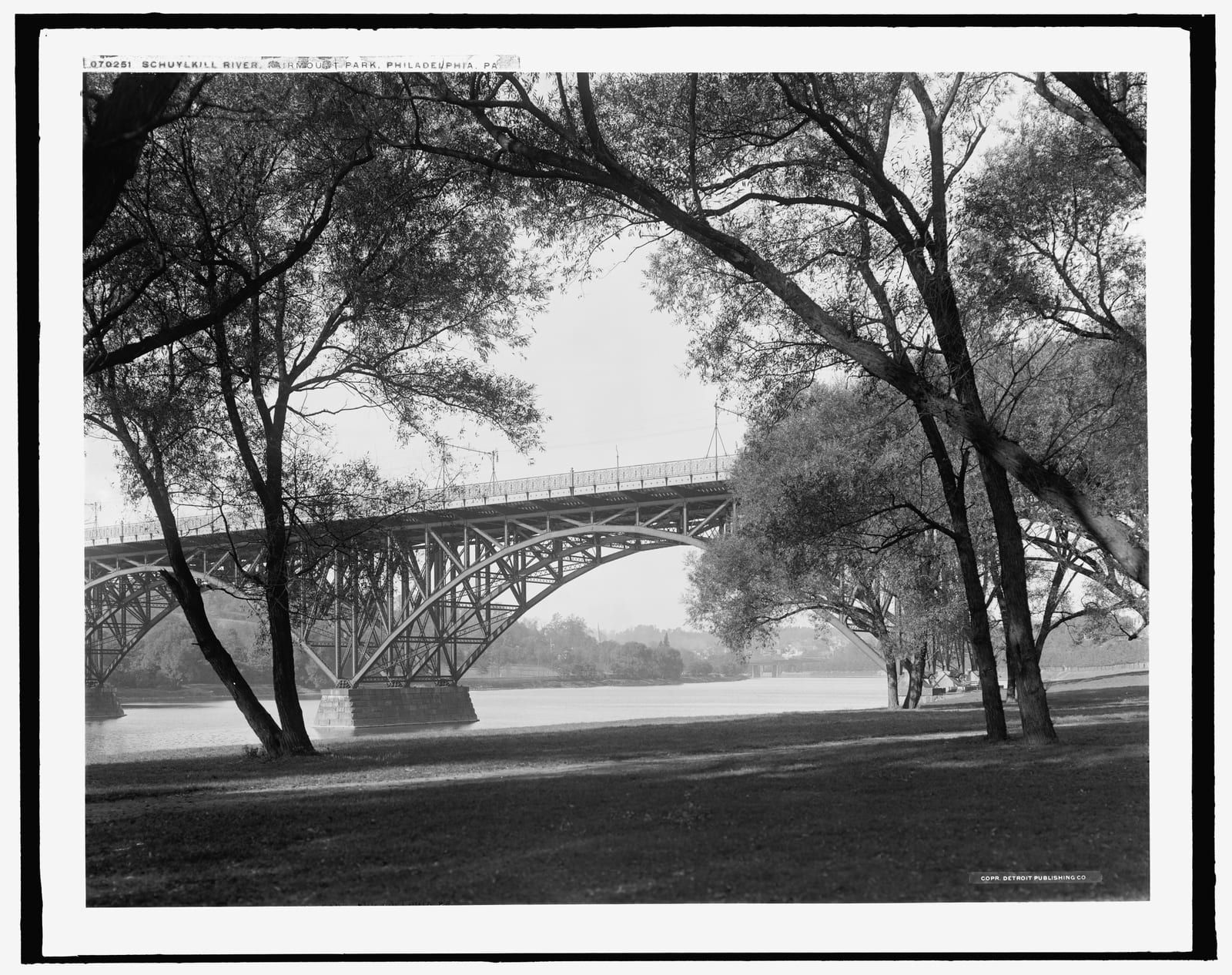
Philadelphia, meanwhile, had staked its health on the river. After the 1793 yellow fever epidemic killed roughly a tenth of the city, Philadelphia built America’s pioneering municipal waterworks on Schuylkill water — Benjamin Latrobe’s steam-powered Centre Square works of 1801, then the celebrated Fairmount Water Works, opened in 1815 and converted in 1822 to draw the river’s own power through waterwheels behind the new Fairmount Dam. Its success made it a wonder of the age — Dickens paid his respects on his American tour — and its defense produced something remarkable: to shield the intake from the industry creeping upriver, Pennsylvania’s 1867 statute creating the Fairmount Park Commission authorized acquiring both banks “for the preservation of Schuylkill water and of the health and enjoyment of the people forever.” One of America’s greatest urban parks began as watershed protection — an idea decades ahead of its time, and one the coal region upstream would ultimately defeat.
The city’s own engineers watched the defeat happen. In 1866 a city engineer reported that below Manayunk “the river assumes a dark, dirty, milky appearance” ; by 1883 the Bureau of Water was cataloguing sewage, dye-stuff, wool-washing, and brewery waste pouring from the upstream towns. The human cost was typhoid fever: outbreaks in 1876, 1888–89, 1899, and 1906, and more than 5,400 typhoid deaths in the 1890s alone. The city’s answer was sand filtration, built at plant after plant from 1901 to 1910 — a protracted rollout whose frustrations made the front page: “Filtered Water 18 Months Off for Entire City,” the Philadelphia Inquirer reported in February 1907. Filtration (with chlorination following in the early 1910s) cut typhoid death rates by more than ninety percent — but it conceded the larger point. The Fairmount works themselves, hemmed in by pollution, were decommissioned as a water source in 1909. The river that had been Philadelphia’s pride was now something to be strained and disinfected before drinking.
The railroad, and the silting-out of the county’s canal
The canal’s dominance was brief. The Philadelphia and Reading Railroad, chartered in 1833, reached Pottsville in 1842 and within a few years was hauling roughly three times the canal’s anthracite. The navigation answered with its costly 1846 enlargement, but the arithmetic never reversed, and after the catastrophic flood of October 1869 — with a drought and a miners’ strike in the same hard season — the company leased its entire works to the railroad in 1870. The canal had become an appendage of its competitor.
Its specifically county fate was choking. The upper sections filled with the coal silt of the county’s own collieries until they were, in practice, unusable: the navigation above Port Clinton was abandoned by about 1887–1891, and by 1890 a system that had once moved 1.7 million tons carried 144,994. The county that the canal had built was the first stretch of it the county’s silt destroyed — decades before the system’s formal end. That end is precisely documented: when the Public Utility Commission dissolved “the 131-year-old Schuylkill Navigation Company” on December 30, 1946, the Associated Press dispatch in Pottsville’s Republican and Herald recorded that “general freight transportation was discontinued in 1929,” that “anthracite shipments cease[d] two years later” — 1931 — and that the company’s “properties, including the Schuylkill Canal and dams recently were transferred without charge to the State for use in the Schuylkill River desilting project.” The dead canal was handed over to become raw material for the cleanup.
| Year | Canal coal / cargo |
|---|---|
| 1822 | 1,480 tons — the first coal, poled down before the tow-path existed |
| 1825 | 5,306 tons — the first full season (company reports; uncorroborated) |
| 1832 | over 200,000 tons |
| 1859 | 1,699,101 tons — the peak (1,379,109 tons anthracite) |
| 1890 | 144,994 tons — after the county reaches were abandoned |
| 1931 | the last anthracite cargo on the system |
Sourcing: the 1822 and 1832 figures are primary-verified in the 1881 county history and the 1931 date in the 1946 Associated Press dispatch (); 1859 and 1890 are corroborated by the Encyclopedia of Greater Philadelphia (); the 1825 season total traces only to company reports ().
The county’s exported poison
If the river’s gift to the county was an outlet for coal, the county’s return gift to the river was coal waste — on a scale that made the Schuylkill notorious the length of its valley. The mechanism is stated plainly on the “Reclaiming the River” heritage marker that stands, tellingly, downstream in Berks County: “To fuel the industrial revolution beginning around 1870, the Schuylkill County mines processed coal and dumped their culm, or waste, into huge piles in the valleys of the Schuylkill River’s tributaries,” from which “the fine anthracite and silt… made their way downstream”; later, coal-washing waste “were sluiced directly into the Schuylkill’s tributaries.” A Berks County monument to a Schuylkill County export.
The county understood its own arithmetic early. The 1881 geology chapter, quoting the mining engineer P. W. Sheafer, recorded that “for every ton shipped to market, two are wasted,” and the visible result was already written on the landscape: “the green slopes of a thousand hills are blotted with the debris of the coal mines.” In the coal towns the culm buried the past outright — at Saint Clair, by 1881, “banks of culm from Hickory colliery now cover the sites of most of” the village’s first houses. Washed into the branches, that culm became the river’s silt. The totals were staggering, and the sources measure them in different units and years that should not be conflated — but they all point the same way. By the eve of the cleanup some 30 million cubic yards of culm had accumulated in the river, with an estimated 3 million cubic yards a year still arriving in 1945 ; the 1927 Army Corps of Engineers estimate put 38 million tons of coal waste in the river and its tributaries. The era’s epitaph for the Schuylkill — “too thick to navigate, too thin to cultivate” — is of unknown authorship, and earned.
Floods in the river towns
The same steep, flashy river that carried the coal periodically destroyed the towns that shipped it. The county’s founding flood memory is the twin floods of 1850 — July 19 and September 2 — the second “tremendously augmented by the bursting of the Tumbling run reservoir,” a twenty-eight-acre impoundment holding “over 23,000,000 cubic feet of water,” whose failure broke away dam after dam down the Schuylkill. The county history calls it “the highest freshet, and the most destructive to life and property, known from memory or tradition to have visited the Schuylkill” ; the Navigation Company’s own president reported “a flood with which nothing that has heretofore occurred in the valley of the Schuylkill within the memory of man can be compared.” The damage forced a special statute — the act of April 7, 1852, “for the protection of the creditors of the Schuylkill Navigation Company,” whose preamble cited “the devastations of floods.” A dozen years later, on June 4, 1862, “a flood of unexampled violence and destructiveness” interrupted the navigation for three weeks and cut the year’s coal supply by “nearly a million of tons.”
The flood of record came on October 4, 1869, when the remnants of the “Saxby Gale” drove the river to seventeen feet and roughly 135,000 cubic feet per second at Philadelphia — the blow that pushed the navigation into the railroad’s arms. And on March 1, 1902, under the banner “TERRIBLE FLOOD,” Pottsville’s Miners’ Journal left the county’s most vivid primary account: “The people of Port Carbon, Schuylkill Haven and other towns down the valley were ready at a moment’s notice to leave their homes and fly to the hills. They feared that the big dams of the Pottsville Water Company and the large dams at Tumbling Run would burst and spread devastation and death throughout the Schuylkill Valley. At St. Clair the people were all out upon the hills as usual…” The paper counted one death — John Gressle, a young man of Saint Clair, drowned “about 1.30 o’clock yesterday,” as the Saturday edition put it — and summarized: “Almost every town in the region suffered some damage from the rising streams.” (Later summaries say the 1902 flood “drowned out” the county’s mines; that characterization comes from downstream and secondary accounts, not from the Pottsville paper’s own report, and the two should not be conflated. ) The gauge would record more high water in 1933, 1946, and 1950 — but by then the river’s defining problem was not what it carried away. It was what it could no longer carry at all.
Reclaiming the river: the cleanup begins at the source
The law was slow to reach the collieries. Pennsylvania’s first statewide anti-pollution statute, the Purity of Waters Act of 1905, pointedly exempted coal-mine discharge; the Sanitary Water Board (1923) and the Clean Streams Law (1937) kept versions of the same carve-out. What finally ended it was a pair of 1945 acts with the river’s own name on them. Act No. 441 — “Prohibiting Pollution of the Schuylkill River,” enacted June 4, 1945 — empowered the state’s Water and Power Resources Board to “clean out, widen, alter, dredge, deepen or change the course, current or channel” of the river, and appropriated five million dollars to begin ; the companion Brunner Bill (Act 177, signed the month before) amended the Clean Streams Law so the Sanitary Water Board “could also begin ordering collieries and washeries to prevent coal silt from being washed into the river.”
The abatement aimed squarely at the county’s own mines — and the county’s own paper tracked it. Five months after Act 441, under “Pleased With Local Mines In Solving Pollution of River With Silt Disposal,” the Pottsville Republican reported “substantial progress in the elimination of silt from coal waste waters in the southern anthracite field.” By April 1947 the progress was measurable: “some 12,000 tons of coal silt are being kept out of the Schuylkill River daily by desilting plants at anthracite collieries in the river basin,” the State Health Department announced, with permits coming for plants at every colliery without one. (The page itself preserves a small discrepancy: the headline reads “1200 TONS DAILY” where the article body reports 12,000 tons a day — the body figure is the one cited here.) Under Sanitary Water Board orders, “the 47 collieries along the river had stopped discharging mine wastes to the river.”
Then the Commonwealth dredged out the residue of a century. The Schuylkill River Project of roughly 1947–1951 — a landmark of American river restoration — removed at least 16.5 million cubic yards of coal silt (later engineering reports run as high as 17.25 million) , demolished worn-out canal dams, built a chain of impounding basins (the engineers’ records document 23 basin contracts; the heritage-area account counts 27 built ), and anchored the system on three new desilting works — dams at Auburn (Landingville) and at Kernsville below the county line, and a low stone weir at Tamaqua on the Little Schuylkill — two of the three in or at the edge of the county whose collieries had made the silt. The total cost ran near $55 million. The project marks the natural end of the river’s first three centuries: the moment the same state that had let the river be poisoned began, deliberately and at great expense, to dig it back out.
The river’s double debt
Schuylkill County’s history with its river is a history of a debt paid twice. The river’s first gift — an outlet to Philadelphia — turned a wilderness of “black stone” into the anthracite capital of the eastern seaboard, quintupled the county’s population in thirty years, and strung the upper valley with canal ports that shipped machinery to the far side of the world. The county’s repayment was silt: two tons of waste for every ton shipped, piled in the tributary valleys and sluiced into the branches until the river choked on it — its own upper canal first. The second payment came from the Commonwealth, whose 1945–51 cleanup arrived in the anthracite field to dredge back out what the county had put in, and left its desilting works at Tamaqua and Auburn working — in the county, because the silt never entirely stopped coming. The basins there still intercept culm today.
The river made the county, and the county nearly unmade the river; every thread of the story — the mined headwaters, the canal begun at Mount Carbon, the culm banks of Saint Clair, the terror at Port Carbon in 1902, the desilting plants “at anthracite collieries in the river basin” in 1947 — is local. What the cleanup began, later decades continued; today the county’s stretch of the recovering river is a place people go on purpose — by canoe on the Schuylkill River Water Trail, on foot along the John Bartram Trail below Auburn, and across the river’s Port Clinton gap on the Appalachian Trail. The hidden creek is worth finding now — which, after the century this article records, is the least hidden thing about it.
Related
People: John Pott (1759–1827)
Towns: Pottsville, Port Carbon, Mount Carbon, Schuylkill Haven, Port Clinton, Saint Clair, Tamaqua, Auburn, Landingville, Minersville
From the archive
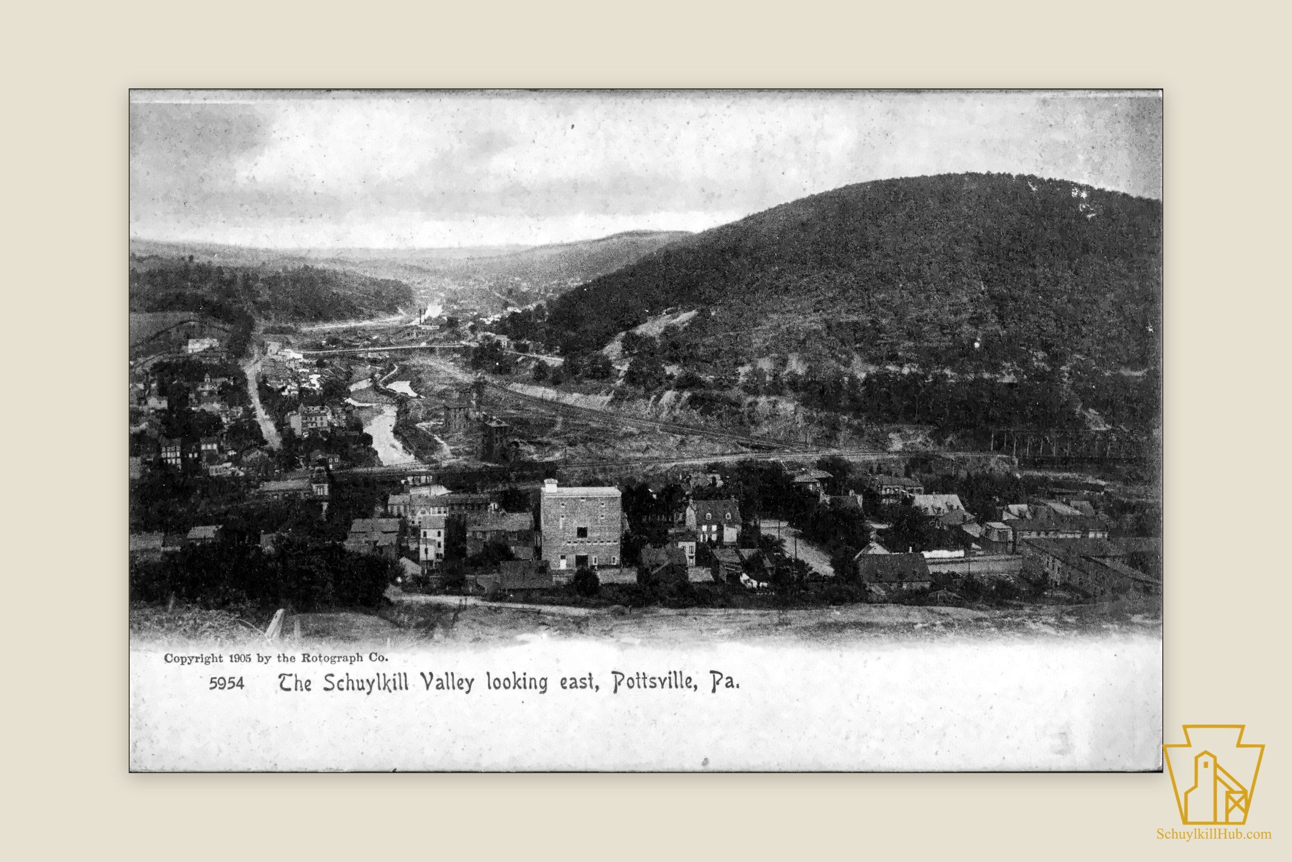
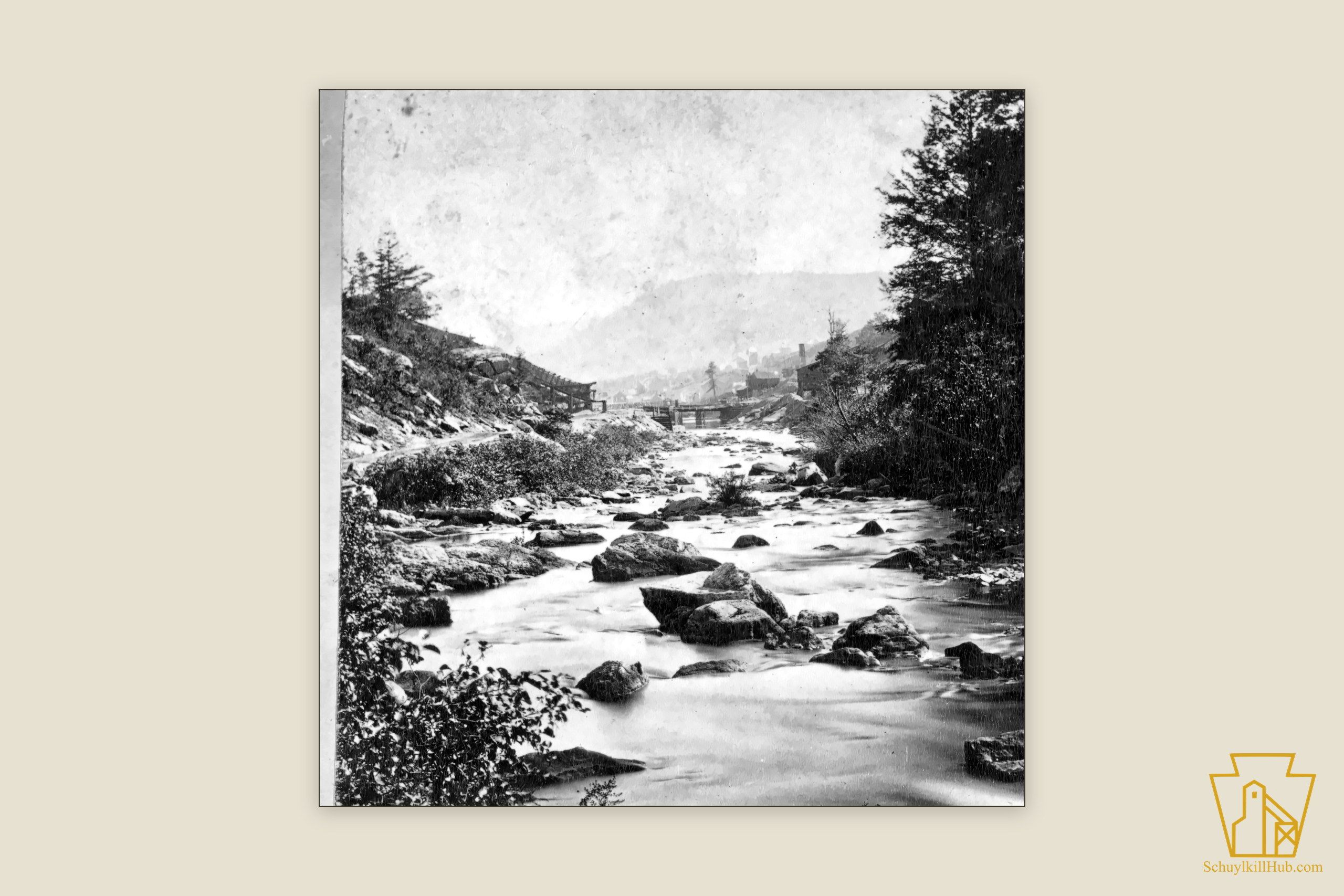
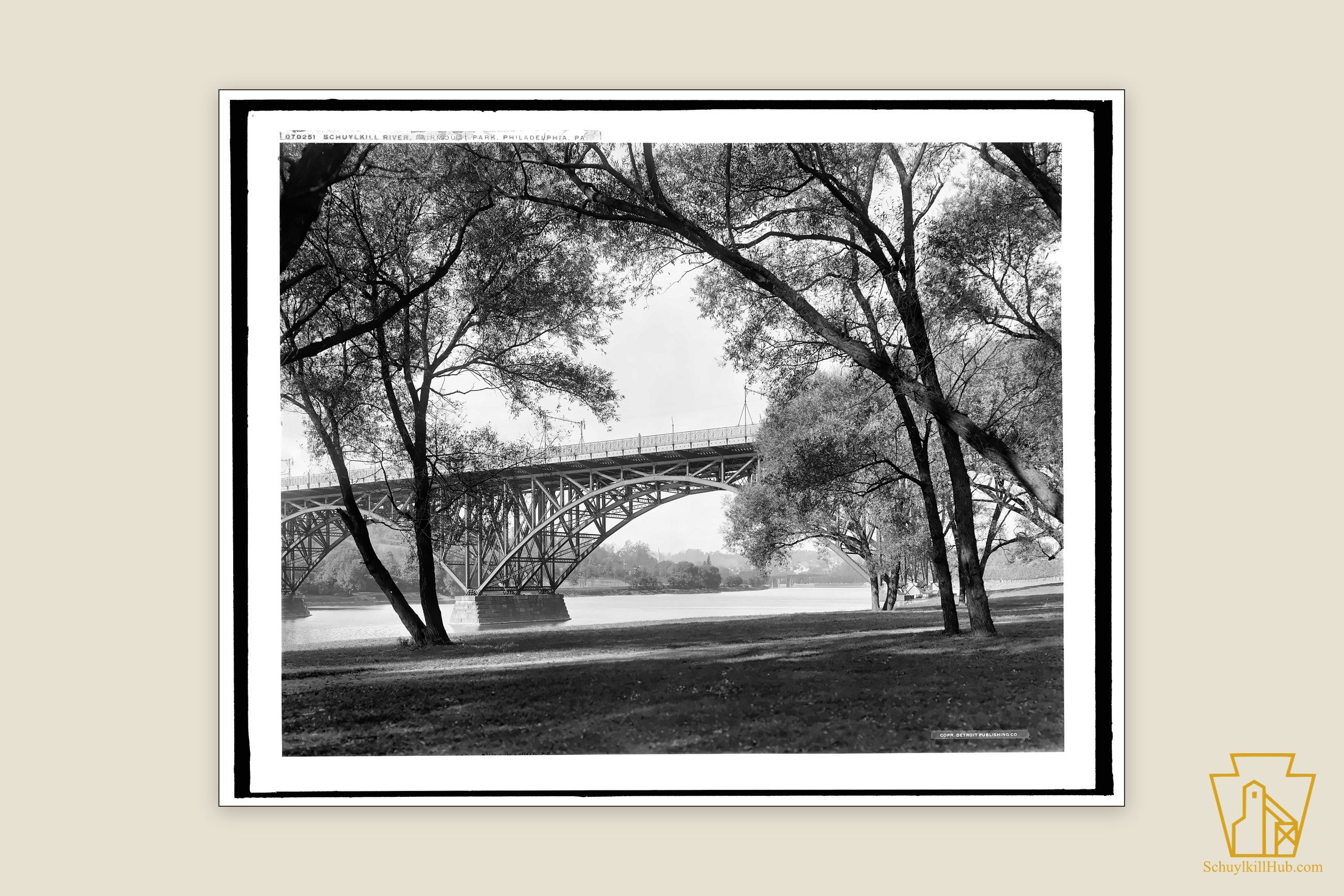
Historic maps and photographs from the Schuylkill Hub archive, each available as an archival print.
Sources
- W. W. Munsell & Co., History of Schuylkill County, Pa. (1881) — the county's period history; every quotation re-verified against the Internet Archive page scans · 1881
License: public-domain - John Heckewelder, "Names Which the Lenni Lenape or Delaware Indians... Had Given to Rivers, Streams, Places" (communicated 1822; American Philosophical Society printing, 1834) · 1834
License: public-domain - Peter Lindeström, Geographia Americae... Based on Surveys and Notes Made in 1654–1656 (Amandus Johnson edition, Swedish Colonial Society, 1925) · 1925
License: public-domain - Francis Vincent, A History of the State of Delaware (1870) · 1870
License: public-domain - Paywalled newspaper reporting — "Terrible Flood," The Miners' Journal (Pottsville), March 1, 1902 (Newspapers.com) · 1902-03-01
License: publisher - Paywalled newspaper reporting — "Pleased With Local Mines In Solving Pollution of River With Silt Disposal," Pottsville Republican, October 19, 1945 (Newspapers.com) · 1945-10-19
License: publisher - Paywalled newspaper reporting — "1200 Tons Daily Kept From River," Pottsville Republican, April 3, 1947 (Newspapers.com) · 1947-04-03
License: publisher - Paywalled newspaper reporting — "131-Year-Old Schuylkill Navigation Co. Dissolved," Republican and Herald (Pottsville), December 30, 1946 (Newspapers.com) · 1946-12-30
License: publisher - Paywalled newspaper reporting — "Filtered Water 18 Months Off for Entire City," The Philadelphia Inquirer, February 14, 1907 (Newspapers.com) · 1907-02-14
License: publisher - Pennsylvania General Assembly — Act No. 441 of 1945, "Prohibiting Pollution of the Schuylkill River" (enacted June 4, 1945) · 1945
License: reference - Chari Towne, A River Again: The Story of the Schuylkill River Project (Delaware Riverkeeper Network, 2012) — full text · 2012
License: reference - NOAA / National Weather Service, Middle Atlantic River Forecast Center — Top 10 Highest Historical Crests: Schuylkill River at Philadelphia (period of record 1769–present)
License: public-domain - Marshall Joseph Becker, "The Lenape" (Lower Merion Historical Society, The First 300)
License: reference - C. A. Weslager, Dutch Explorers, Traders and Settlers in the Delaware Valley, 1609–1664 (University of Pennsylvania Press, 1961) · 1961
License: reference - Brenna O'Rourke Holland, "Schuylkill Navigation Company," The Encyclopedia of Greater Philadelphia
License: reference - Howard Gillette Jr., "Schuylkill River," The Encyclopedia of Greater Philadelphia
License: reference - Steven J. Peitzman, "Typhoid Fever and Filtered Water," The Encyclopedia of Greater Philadelphia
License: reference - Lynn Miller, "Fairmount Water Works," The Encyclopedia of Greater Philadelphia
License: reference - Adam Levine, "Manayunk and the Schuylkill Navigation" (Water History PHL, Philadelphia Water Department, 2014) · 2014
License: reference - Edward J. Gibbons, "The Building of the Schuylkill Navigation System, 1815–1828," Pennsylvania History 57, no. 1 (1990), 13–43 · 1990
License: reference - "Reclaiming the River" — Schuylkill River National & State Heritage Area interpretive marker, Muhlenberg Township, Berks County (Historical Marker Database)
License: reference - Schuylkill River Greenways National Heritage Area — "About the Watershed"
License: reference - Nicoline van der Sijs, Cookies, Coleslaw, and Stoops: The Influence of Dutch on the North American Languages (Amsterdam University Press, 2009), p. 54 · 2009
License: reference - Schuylkill River Greenways National Heritage Area — "Schuylkill River Trail" (the heritage area's own pronunciation: "pronounced SKOO-kill")
License: reference
Frequently asked
- What does "Schuylkill" mean?
- It is Dutch — and literally a creek: schuilen ("to hide or shelter") plus kil ("channel" or "creek") gives "hidden creek." An 1870 history explains that the Dutch named it "from the retired and hidden situation of its mouth," which sediment and marsh concealed from vessels passing on the Delaware. The familiar modern rendering "hidden river" is a paraphrase — kil was the colonial Dutch word for a creek or channel, while the Dutch used their word for a river, rivier, for the great streams: the Delaware was their "South River." The naming is traditionally attributed to the Dutch West India Company agent Arendt Corssen, around 1633.
- Where does the Schuylkill River begin?
- Entirely in Schuylkill County. The East Branch rises on mined ground between the village of Tuscarora and Tamaqua (the spot is identified in modern gazetteers as Tuscarora Springs); the West Branch rises near Minersville; the branches join at Schuylkill Haven; and the Little Schuylkill joins the main stem at Port Clinton, where the river leaves the county through the gap in Blue Mountain. It reaches the Delaware at Philadelphia roughly 135 miles from its source.
- What was the Schuylkill Navigation?
- A 108-mile system of canals and slackwater pools that connected the Schuylkill County coalfield to Philadelphia. Chartered March 8, 1815, it built its first dam at Mount Carbon in spring 1817, opened for the coal trade by 1825, and reached its upper terminus at Port Carbon in 1828. It was the artery that opened Schuylkill County's anthracite to the Philadelphia market by water. (The rival Lehigh Navigation had proved the anthracite-canal concept first, in 1820; the Schuylkill was the county's own outlet.)
- When did the Schuylkill canal stop carrying coal?
- In stages, from the top down. The upper reaches in Schuylkill County — choked by the county's own coal silt — were abandoned by about 1887–1891. On the system as a whole, general freight ended in 1929 and the last anthracite cargo moved in 1931, as an Associated Press dispatch recorded when the company was formally dissolved on December 30, 1946. Its canal and dams were then transferred to the Commonwealth for the desilting project.
- Why was the Schuylkill River so polluted?
- Coal silt. From about 1870, collieries in Schuylkill County dumped culm — fine coal waste — into the tributary valleys, and coal-washing water was sluiced directly into the streams. By 1927 the Army Corps of Engineers estimated the river system held 38 million tons of coal waste; by 1945, on the eve of the cleanup, some 30 million cubic yards of culm had accumulated in the river, with an estimated 3 million cubic yards more arriving each year.
- How do you pronounce Schuylkill?
- SKOO-kill — the phonetic the Schuylkill River Greenways National Heritage Area itself prints ("pronounced SKOO-kill"). The Dutch spelling misleads English readers: the "uy" reads as a long OO, and the name is two syllables.
- How long is the Schuylkill River?
- About 135 miles from its Schuylkill County headwaters to the Delaware River at Philadelphia — a conventional figure rather than a formally certified channel measurement. It is often conflated with the length of the canal system built alongside it: the Schuylkill Navigation ran about 108 miles, from Port Carbon to Philadelphia.
- What was the Schuylkill River Project?
- Pennsylvania's landmark river cleanup, authorized by Act 441 of June 4, 1945 ("Prohibiting Pollution of the Schuylkill River") and the companion Brunner Bill, which ended the coal industry's exemption from the Clean Streams Law. From roughly 1947 to 1951 the Commonwealth dredged at least 16.5 million cubic yards of coal silt from the river, built desilting works at Tamaqua, Auburn (Landingville), and Kernsville, and — under Sanitary Water Board orders — made the 47 collieries along the river stop discharging waste.